Autodesk AutoCAD Map 3D

£57.98£119.98

Autodesk AutoCAD Map 3D is a powerful software for geospatial mapping and GIS applications. It enables engineers and planners to create, analyze, and manage spatial data for infrastructure projects. Perfect for urban planning, civil engineering, and utility management.

  • Provides tools for GIS integration, spatial analysis, and map creation.
  • Choose from versions 2023, 2024, 2025, or 2026 to fit your workflow.
  • Delivered as a license key via email shortly after purchase.
Platform

Windows

Version

2022

,

2023

,

2024

,

2025

,

2026

,

Bundle (All)

Validity

1 Year

,

2 Years

,

3 Years

3 Years
Windows
2023
2024
2025
2026
1 Year
2 Years
3 Years
We're always here Reach out anytime, we'll get back shortly.
SSL Protected Your data is encrypted and secure.
Secure Stripe Checkout Powered by Stripe payment security.
Fast Delivery Access your product right away.
SKU: UPK21-ADK-312 Categories: , Brand:
Description

Delivery Information: This is a digital license key delivered via email shortly after purchase. Please ensure the email address provided at checkout is correct to allow for seamless activation.

This license is issued as an educational version, offering the same core features and functionality as the commercial release. Exported files and print outputs do not contain any watermarks or license-type indicators.

Autodesk AutoCAD Map 3D – Professional GIS and Mapping Software

Advanced GIS and mapping software for creating precise maps, analyzing geospatial data, and managing infrastructure projects. Perfect for surveyors, civil engineers, and GIS professionals seeking comprehensive mapping tools. Fast digital delivery with competitive pricing for professional geospatial solutions.

Professional GIS & Mapping Tools Included

GIS Data Management
GIS Data Management
Spatial Analysis Tools
Coordinate Systems
Coordinate Systems
Raster Design Tools
Raster Design Tools
Database Connectivity
Topology Creation
Topology Creation
Map Styling & Themes
Data Import/Export
Data Import/Export

Complete GIS solution with advanced mapping capabilities and geospatial analysis tools

Key GIS & Mapping Capabilities

Geospatial Data Management

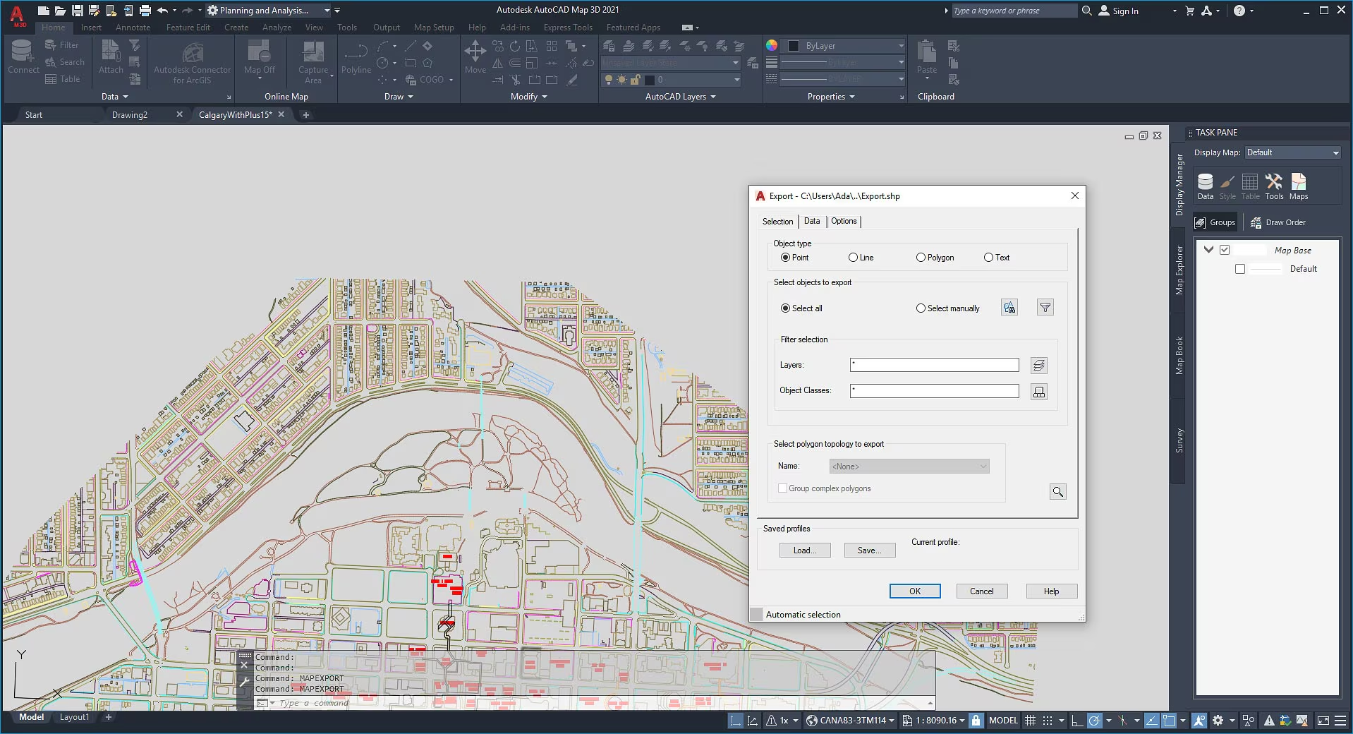
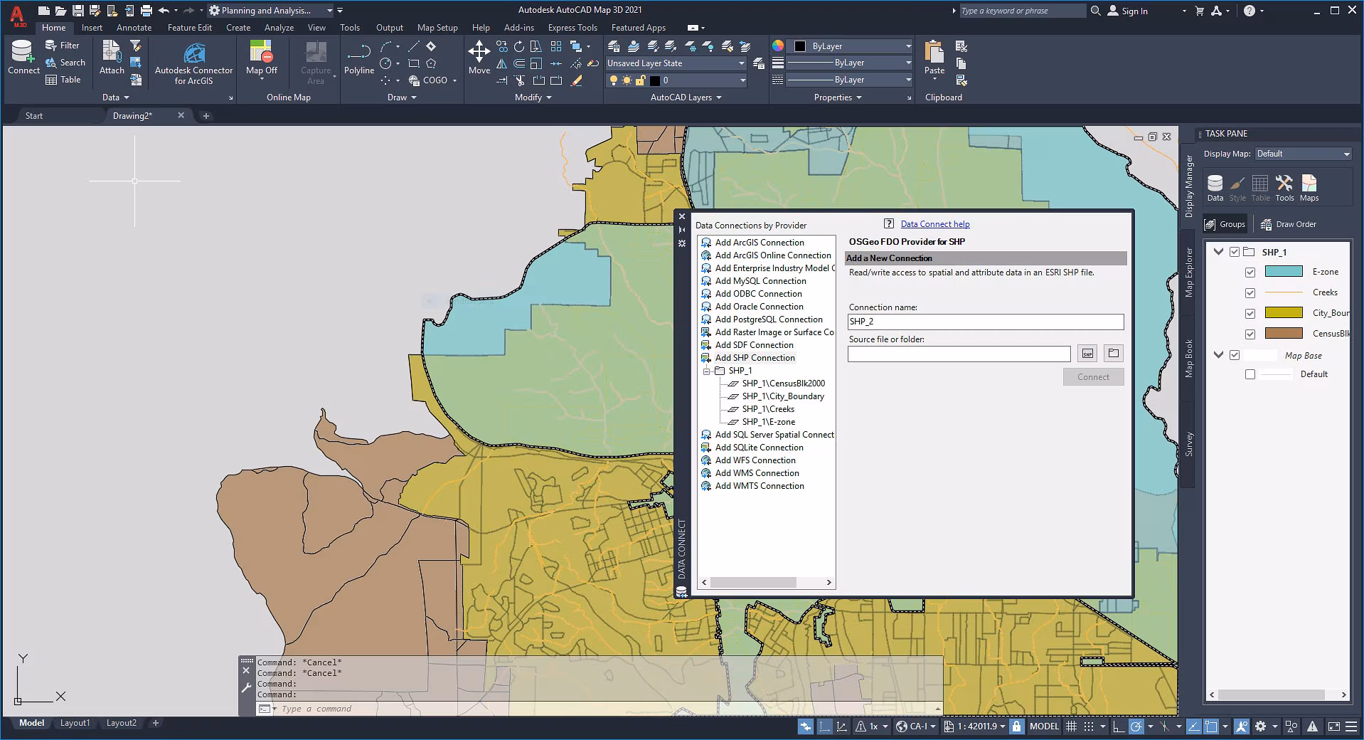
Connect to multiple data sources including SHP, GeoJSON, Oracle Spatial, SQL Server, and PostGIS for comprehensive data integration and management.

Advanced Spatial Analysis

Perform buffer analysis, overlay operations, proximity analysis, and spatial queries to extract meaningful insights from geographic data.

Coordinate System Support

Work with thousands of coordinate systems and projections with automatic transformation capabilities for global mapping projects.

Raster Image Processing

Process and analyze satellite imagery, aerial photos, and scanned maps with advanced raster editing and vectorization tools.

Topology & Network Analysis

Create and maintain topological relationships, perform network tracing, and analyze connectivity for infrastructure management.

Professional Map Production

Create high-quality maps with advanced styling, thematic mapping, labeling, and layout tools for professional cartographic output.

AutoCAD Map 3D Interface & GIS Environment

AutoCAD Map 3D GIS interface and mapping tools
GIS interface and mapping tools
AutoCAD Map 3D spatial analysis and data management
Spatial analysis and data management
AutoCAD Map 3D coordinate systems and projection tools
Coordinate systems and projection tools

License & Duration Information

Version Selection

Choose your preferred AutoCAD Map 3D version (2023, 2024, 2025, or 2026) from the available variations. Each version includes comprehensive GIS tools, spatial analysis capabilities, and data connectivity at competitive pricing.

License Duration

Select from 1-year, 2-year, or 3-year license periods. Longer duration options provide better value and ensure continuous access to updates and new GIS features for your mapping projects.

System Requirements

Windows Windows Requirements (Windows Only)

  • OS: Windows 11, Windows 10 (64-bit)
  • CPU: 2.5+ GHz (Intel i5 or AMD equivalent)
  • RAM: 8 GB (16 GB recommended)
  • GPU: 1 GB with DirectX 11
  • Storage: 9.0 GB free space
  • Display: 1920 x 1080 True Color

Note: AutoCAD Map 3D is available for Windows operating systems only. Mac version is not available.

Industry Applications

Urban Planning

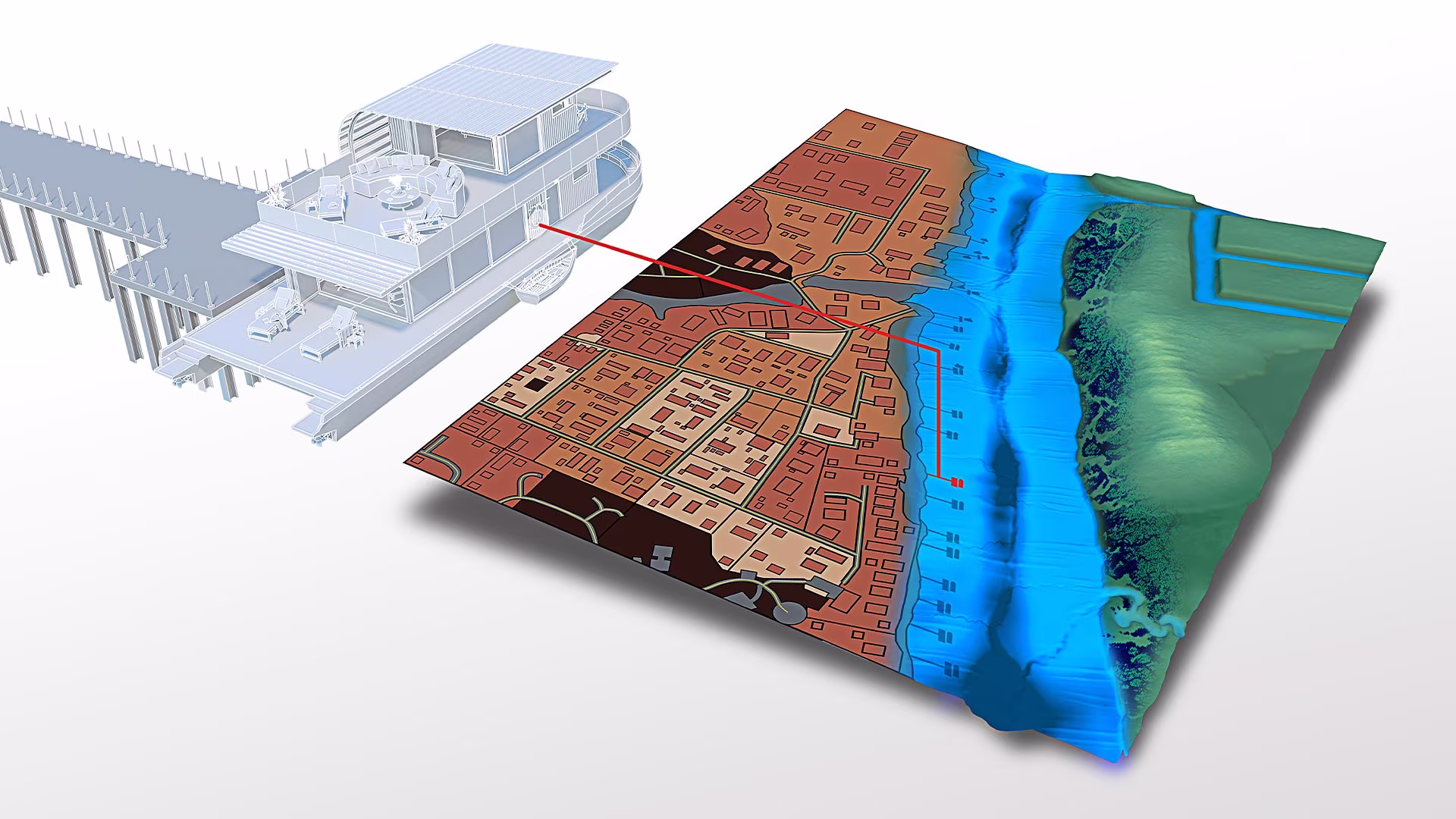
City planning, zoning analysis, land use mapping, and development planning with comprehensive spatial analysis tools.

Utilities & Infrastructure

Water, gas, electric utility mapping, network analysis, and infrastructure asset management for utility companies.

Transportation

Highway design, traffic analysis, route optimization, and transportation network planning for DOT and engineering firms.

Environmental Services

Environmental impact assessment, natural resource management, and ecological analysis for environmental consulting.

Government & Public Safety

Emergency response planning, public safety mapping, census data analysis, and government asset management.

Surveying & Engineering

Land surveying, boundary mapping, topographic analysis, and civil engineering design with precise coordinate systems.

Core GIS & Mapping Features

Feature Description
Data Connectivity Connect to Oracle Spatial, SQL Server, PostGIS, MySQL, and file-based data sources.
Spatial Analysis Buffer, overlay, proximity analysis, and advanced spatial queries for data insights.
Coordinate Systems Support for thousands of coordinate systems with automatic transformation capabilities.
Raster Processing Advanced raster image editing, vectorization, and georeferencing tools.
Topology Tools Create and maintain topological relationships for network and connectivity analysis.
Map Styling Advanced styling, thematic mapping, and cartographic tools for professional map production.
Data Import/Export Support for SHP, GeoJSON, KML, DXF, and other industry-standard formats.
3D Visualization 3D mapping and visualization capabilities for terrain and elevation analysis.
Attribute Management Comprehensive attribute data management with database integration and editing tools.
Report Generation Generate detailed reports, statistics, and documentation from spatial analysis results.

Professional AutoCAD Map 3D GIS Software

Advanced GIS and mapping solution available at competitive prices with fast digital delivery via email. Get started with your AutoCAD Map 3D license today.

Additional information
Platform

Windows

Version

2022

,

2023

,

2024

,

2025

,

2026

,

Bundle (All)

Validity

1 Year

,

2 Years

,

3 Years

3 Years
Reviews (0)

Reviews

There are no reviews yet.

Be the first to review “Autodesk AutoCAD Map 3D”

Your email address will not be published. Required fields are marked *

Shipping & Delivery
Important purchase and activation information
Learn More

Related products